
In 2012, I caught NSIDC cheating, just as Arctic sea ice extent was about to cross above the 1979-2000 average. They changed their measurement system using a completely bogus mathematical trick. NSIDC argued with me about it for a while, and eventually admitted that their nature trick was garbage.

NSIDC’s 2012 Nature Trick | Real Science
They have done a much bigger cheat this time, in order to generate this propaganda:
ice at least 5 years or older, is at its smallest level in the satellite record, representing only 3 percent of the total ice cover
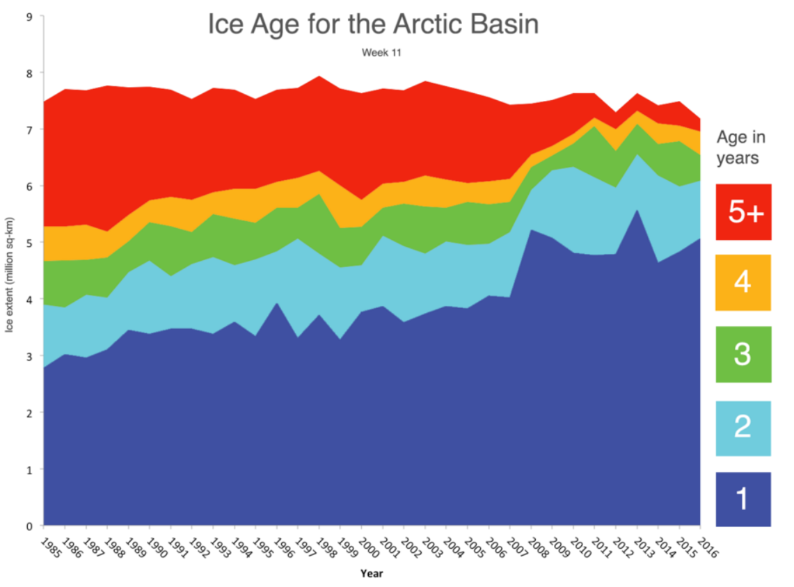
March ends a most interesting winter | Arctic Sea Ice News and Analysis
From week 1 1984 to week 37, 2015 NSIDC generated ice age maps in this format:
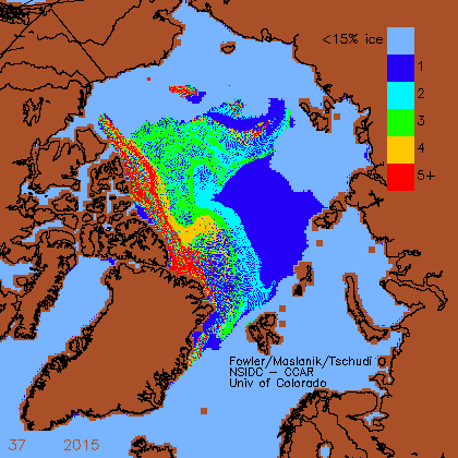
ftp://ccar.colorado.edu/pub/tschudi/iceage/gifs/
Week 38 (late September) is the week when the ice has its birthday, and all of the ice advances one year. I generated the map…
View original post 216 more words
